Avola Creek
| Listing Number: | K8 |
|---|---|
| Size: | 135.23 Acres |
| Map Reference: | 82M14 |
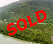
| Price: | SOLD |
| Legal: | District Lot 2966, Except Part in Red on Plan A448 & Plan H8060, Land District 25, Kamloops Division of Yale PID: 007-573-928 |
| Description: | The property has approximately 1/2 mile of river frontage along the North Thompson River. There is a small creek running from the hills to the west, and through the centre of the property but it is not known how large this creek is or if it is year round. The town of Avola is one mile due north of the property. The west side of the property rises from the highway in several benches to the west and gives you great views of the river and surrounding area. The west side of the property is surrounded on three sides by crown land. The property on the east side of the highway is flat and level with some low wet areas. There is a number of large meadows throughout this area and there is evidence of an old homestead along the river. The property is dissected by the highway through the centre, a gas-line runs along the west side of the boundary, and the railroad runs beside the highway through the centre of the property. Just south of the property is a small ranch on the riverbanks of the Thompson River. |
| Location: | The property is located on the Thompson River one mile south of Avola, which is approximately 189 km (117 miles) north of Kamloops. Kamloops is a 3 1/2-hour drive from Vancouver, due north along the Coquihalla Highway. |
| Access: | Access to the west side of the property is off the main Yellowhead Highway 5, through a gravel pit and then a small road winds up to the top of the property. Access to the east side of the property is via the town of Avola. Turn right (east) and go to a road along the river and then cut straight south. Follow this road onto the property and then continue within a couple hundred feet of the riverbank all the way along the property right to the south border. Air Service: The nearest major airport is located at Kamloops. There is an airport for charter flights located at Valemount, and an airstrip at Blue River. Rail Service: With 48 hours advance notice, Via Rail offers service to Clearwater, Blue River, and Valemount. |
| Recreation: | The Clearwater and North Thompson rivers provide excellent opportunities for salmon fly-fishing in the fall. The multiple lakes attract fishermen from all over the world for the large trout swimming below the water’s surface. Try Murtle Lake, the largest non-motorized lake in British Columbia. Wells Gray Provincial Park: Located to the southwest of Avola, access to the park can be made from Clearwater, 63 km (38 miles) south of Avola or by using the restricted road at Blue River to Murtle Lake. Wells Gray Provincial Park is one of BC’s largest and most spectacular parks (529,748 Hectares or 1308 acres). Scenery includes alpine meadows, snow-capped peaks, lakes, waterfalls, extinct volcanoes, lava beds and mineral springs. Facilities are available for camping, hiking, canoeing, and white water rafting. In summer, there is a popular 2-day intermediate canoe run on the North Thompson River; put in at Avola and paddle to Clearwater. Wells Gray Provincial Park is one of the largest wilderness reserves in British Columbia, with many different species of animals and birds to be found here. Mount Robson Provincial Park: Mount Robson Provincial Park is the second-oldest provincial park, and is part of the Canadian Rocky Mountains World Heritage site, as designated by UNESCO in 1990. Mount Robson provides everything from developed, vehicle-accessible camping to remote valleys that seldom see a human footprint. Golf lovers will enjoy the challenges at Wells Gray Golf Course and Lacarya Golf Course. Clearwater is famous for its white water rafting and kayaking opportunities. The Clearwater River has several sections of rapids, but most rafters and kayakers head towards the outlet of Clearwater Lake for thrills and chills. In the winter, try the slopes at the Clearwater Ski Hill, offering T-bar service and night skiing. Blue River is a base for heli-skiers and the site of Mike Wiegele’s heliski village, which is internationally renowned for the extreme skiing opportunities here, with 1000 peaks and runs over 7000 kilometres of terrain. Cross country skiing and ice fishing at Eleanor Lake is also available for winter activities. Avola Creek is only 1 1/2 hours away from Valemount, BC, home to Valemount Glacier Destinations, a new $100 million planned ski resort on Mount Pierre Elliott Trudeau. This location opens lift access to one of the best snow zones and reliable climates for snow sports on the continent. Construction is planned to start next summer 2018 and will continue for two years before the project will open,” The entire site will be completed within a 15- to 20-year period over three phases. The resort will have a total of 1,997 commercial and residential bed units at completion.” (Western Investor) |
| Services: | Power is available to the property. You may use your cell phones on the property. |
| Area Data: | Avola (population: 40), perched on the banks of the beautiful North Thompson River, is located 40 km (25 miles), south of Blue River and 43 km (27 miles) north of Vavenby on Yellowhead Hwy 5. Named after a town in Sicily, Avola is a small unincorporated community situated along a main line of the Canadian National Railway. Most of the community sits on a slight hill with access to the North Thompson River on the north side. Businesses in Avola include a restaurant and gas station, motel and pub. You can find propane and diesel at the service station if you require it. There is also a neighbourhood pub called the Log Inn Pub that serves bottled beverages and various drinks. The Log Inn’s claim to fame is its famous, ‘Mother of all Burgers’ – very big and very tasty – famous since 1991. The Log Inn Pub is also a favourite of Harley Davidson Motorcycle riders with various Harley Davidson memorabilia proudly displayed on the walls. The Log Inn Pub is sometimes host to the ‘Tucker Run’, a informal event held yearly usually in August. The ‘Tucker Run’ features a tent camp out with pig roast barbecue. Clearwater: A service centre to a population of 4150 and gateway to Wells Gray Provincial Park, the District of Clearwater was established on December 3, 2007. A popular tourist destination in the summertime, Clearwater’s services include a full size grocery store, R.C.M.P station, Fire Department, schools, hospital, banks, golf course, hotels, pubs and restaurants. The surrounding area is mostly small cow-calf cattle ranches with some horse ranching and a number of hobby farms throughout the area. North Thompson River Valley: The North Thompson River Valley is located in the southeast region of British Columbia, beginning just north of Kamloops, and following Highway 5 to Valemount in the north. This region includes Wells Gray Provincial Park. The North Thompson River Valley is about 360 to 675 kilometres east of Vancouver, and is, under good driving conditions, about a four to eight hour drive by car from the Lower Mainland. The Northern Thompson River Valley is a sparsely populated area boasting spectacular scenery. The glacier-fed North Thompson and Clearwater Rivers snake their way through vast cedar, fir, juniper, and spruce forests. As you make your way up past Avola, you enter the majestic Cariboo Mountains, in which alpine lakes and crystal creeks are scattered through mountaintop meadows. The communities here, with a few exceptions, are tiny, but all are friendly and willing to lend a hand or offer advice. For the most part, this region is relatively dry, with long cold winters and short summers of moderately warm days and cool evenings. However, the area surrounding Blue River can receive heavy snowfalls, up to four metres in a season. Temperatures can range from -30 degrees celsius in the winter at Valemount in the Cariboo Mountains to 19 degrees celsius in the summer around Clearwater and Barriere. The North Thompson River Valley, and Wells Gray Park in particular, is considered a key wildlife preservation area. Wells Gray is noted for its black and grizzly bear populations, with black bears ambling along the roadside in May and June. Wells Gray also protects the largest remaining herd of mountain caribou in southern British Columbia. Other animals found in this area include wolf, cougar, lynx, bobcat, wolverine, moose, deer, mountain goat, as well as a host of smaller mammals such as fisher, marten, mink, weasel, and squirrel. Bird species number over 200 in the North Thompson River Valley, including osprey, golden eagle, merganser, grouse, ptarmigan, and the tiny rufous hummingbird. |
| History: | The Thompson Valley was inhabited by the First Nations peoples when the first travelers came south through the mountains in the 1860’s on their way to search for gold in the Fraser Valley and Cariboo region. The Valley was first settled shortly before the turn of the century. In the early days, the easiest mode of transportation was by steamboat, which traveled as far north as Vavenby. The last steamboat trip was in 1914, then in 1916 the CN Rail line was constructed through the Valley and became the major transportation mode, until Highway #5, the Yellowhead Highway, was constructed in the late 1960’s. The name Avola was borrowed from a city in Sicily. During the construction of the Canadian Northern Railway in 1913 a post office was established in Avola. Logging and farming are essential to the economy of the area as they were at the beginning of the century when settlers came to Avola following the construction of the railway. |
| Vegetation: | Years ago a portion of the coniferous trees were harvested on this property, opening the terrain and leaving the deciduous trees to grow freely. There are a number of small stands of merchantable timber left on the property. |
| Boundaries: | Surveyed by H. R. Christie, January 1914. |
| Taxes: | $438.72 (2017) |
| Zoning: | RL-1 (Rural) Thompson-Nicola Regional District. ALR Status: The portion of the property on the west side of the highway is not in the ALR. The portions of the property on the east side of the highway are in the ALR. |
| Sold Date: | 03/23/18 |


