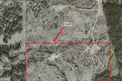
Ootsa Reach
| Listing Number: | OM54B |
|---|---|
| Size: | 80 Acres |
| Map Reference: | 93F |
| Price: | SOLD |
| Legal: | DL 469, LD 13, Part S 1/2 of SE 1/4, 015-493-458 |
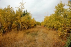
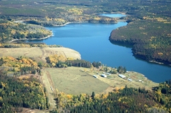
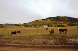
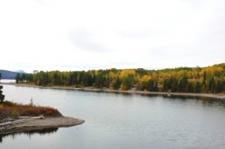
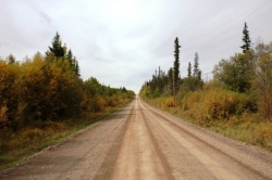
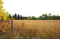
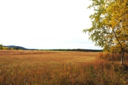
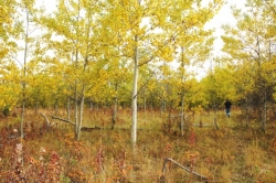
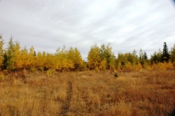
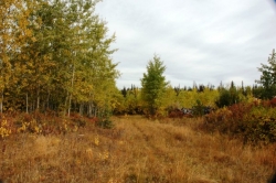
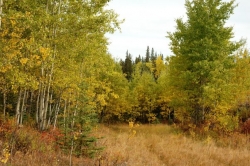
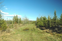
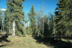
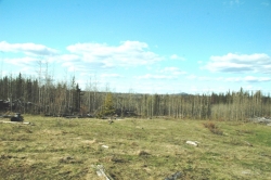
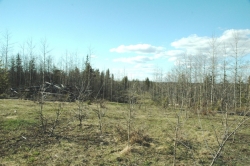
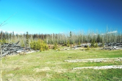
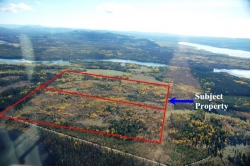
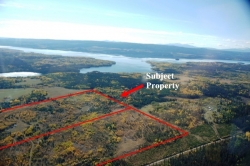
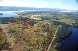
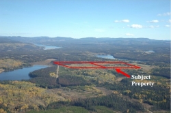
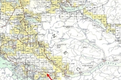
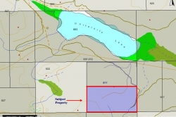
| Description: | The landscape of this property gently undulates throughout. Good level benches provides panoramic views of the snowcapped mountains standing guard over the surrounding countryside and lakes in the area. It is cleared, with a gully running through the southeast corner of the property.This gully is nicely shaded by stands of a mixture of deciduous and coniferous trees. While there are trails running through this property, the closest road access is to the north on NIHO’s North Ootsa Reach. NIHO is currently in the process of establishing an easement to provide direct access. There are some slash piles left from when the property was last logged. However, they have been properly piled on the landings for disposal. It would only take a couple of days work to burn this debris during the fall season. It would burn well with little debris left over afterwards. The adjacent owners to the south and west have completely cleared their property, and have put their property into full hay production. Along with the hayfields, the pastoral backdrop to this amazing property is provided by the several ranches in this area. The several lakes in this area offer you access to some of the best water sports in the province. University Lake is a short walk through Crown land close to the property. Chief Louis Arm is less than a kilometre away from this property. The closest boat launch to Ootsa Lake is only 21 km (13 miles) away, allowing you access to one of the most spectacular lake chains in British Columbia. |
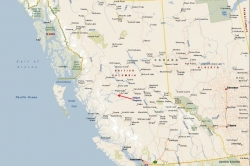
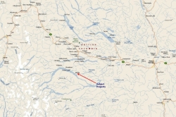
| Location: | This property is located close to Chief Louis Arm, 87 km from the Village of Burns Lake. |
| Access: | From Vancouver: Prince George is about 788 km (489.6 miles) from Vancouver, driving north on Highway 97.
From Edmonton: Prince George is about 739 km (459.2 miles) from Edmonton, driving west on Highway 16.
The airport at Burns Lake can handle smaller private aircraft and charters. The nearest commercial airport is at Smithers. Regular air service is provided by Air Canada’s Jazz Airlines, Central Mountain Air, and Northern Thunderbird to Vancouver and other points in British Columbia. Prince George Airport is the regional airport for Northern B.C., and is expected to play a key role in the economic development of the area. The airport is undergoing a major expansion, with renovations to its runways and international cargo plane fuelling capacity recently completed. At the end of the expansion, the airport is expected to be able to accept 747 airplane landings. The airport opened an International Customs and Canada Border Service area in 2005 and currently accepts international charter flights. |
| Recreation: | Ootsa Lake is a man-made lake created by the flooding of the Ootsa Lake region in the 1950’s. It is a beautiful large lake which offers some of the best boating in the province of British Columbia. This huge reservoir links together many lakes including Tahtsa, Whitesail and Natalkuz, popular destinations for fishermen from all over the world. These waters can yield spectacular results for large Rainbow and giant Lake Char. Rainbow trout up to 15 pounds have been reported caught in Ootsa Lake. These lakes attract wildlife of all sorts, and provides excellent opportunities for hunting and wildlife photography. This property is located close to large tracts of open Crown land, with public access for horseback riding, quad and ATV use, as well as snowmobiling in the winter. Nearby Francois Lake is approx. 110 km (68miles) long, making it the second largest natural lake in British Columbia. It offers excellent rainbow trout and char fishing. Rainbow trout up to 5 and 6 pounds and lake trout (char) to 15 pounds are not uncommon. The entire area known as the Lakes District is famous for its excellent fishing and game. There are a number of resorts throughout this area which offer boating, fishing, hiking, horse-back riding, camping, cross country skiing and many other activities. Ootsa Lake forms the northern border of North Tweedsmuir Provincial Park, one of the most scenic provincial parks in the province. Tweedsmuir Provincial Park appeals primarily to outdoor recreationists interested in boating, angling, camping, hiking or hunting in one of North America’s most magnificent wilderness areas. Outdoor recreation opportunities are almost unlimited. Parts of the park are open to hunting in the fall. |
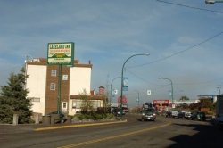
| Area Data: | Burns Lake is the nearest community with a population of 2,000 in the village. The first thing that strikes you when you enter this town is the welcoming sign with enormous chainsaw-carved trout and the inscription “Three Thousand Miles of Fishing”. The other large community close to the Noralee Estates is Houston with 4173 citizens. This community is known as the “Steelhead Capital of Canada” due to the unparalleled fishing in the nearby lake and river systems. Ootsa Reach is located within the Lakes District which is noted for sunny skies and moderate rainfall of less than 20 inches per year. This area is known for clean air, friendly people, inviting lakes, wandering country roads, abundant wildlife and the spectacular beauty of nearby Tweedsmuir Provincial Park. |
| History: | Ootsa Lake: In 1906, Harry Morgan and his young partner journeyed from Bella Coola to Ootsa Lake, settling in what is now known as the Ootsa Lake Settlement. The next spring, pack trains followed bringing other European settlers to join them. The community grew, building roads, stores and farms. By 1916, the first school was founded. The road to nearby Houston was completed in 1917, allowing more settlers and supplies to flow into the community. In March 1952, the Ootsa Lake Region, including the communities situated around Ootsa Lake, was flooded to generate electricity for the new Alcan plant in Kitimat. Many settlers moved away, leaving a core of old settlers to remain close to their old homes. Burns Lake is called the “Heart of the Lakes District” and “Gateway to Tweedsmuir Park”. The village takes its name from Michael Byrnes, an explorer in the area who passed by the lake in 1866. Settlers were initially drawn to the area by the promise of gold in the Babine Lake vicinity. The actual village was formed in 1914 to service the workers creating the Grand Trunk Pacific Railway through the area. The arrival of the railway opened the forest industry, drawing more settlers and creating a stable economy for the area. |
| Taxes: | 0.00 |
| Zoning: | Zoned RR1 (Rural Resource). Agriculture, single, multiple and seasonal dwellings, logging and silviculture, guest ranch, rural retreat, unpaved airstrips and helipads are permitted here. Dwellings on the property are restricted to four seasonal dwellings, two single family dwellings or one two family dwelling. This property is not in the ALR. |
| Sold Date: | 29/05/2008 |

