Amberty Creek & Tamarac
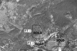
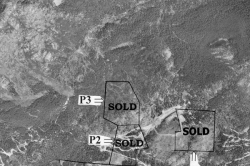
| Listing Number: | Princeton 4 & 5 |
|---|---|
| Size: | Princeton 4 – 51.65 Acres |
| Map Reference: | 92H6 |
| Price: | SOLD |
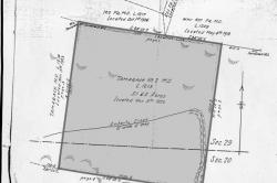
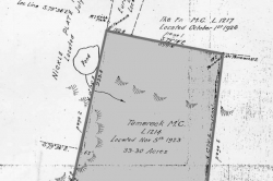
| Legal: | District Lot 1213 & 1214, Surface Rights to M/C, Yale Land District 59 |
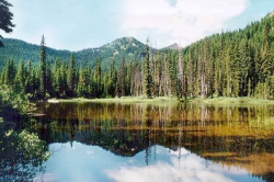
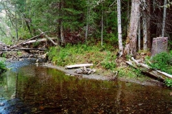
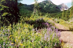
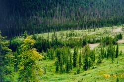
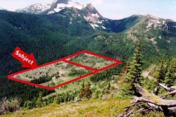
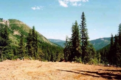
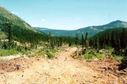
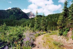
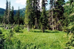
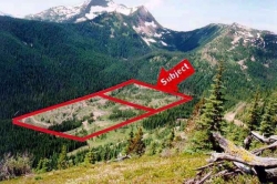
| Description: | These properties are located in a very private alpine valley surrounded by a horseshoe of mountain peaks. There are abundant trails for hiking or mountain biking in the summer, and cross country skiing or snowmobiling in the winter. Both properties are fairly flat with rolling topography and plenty of room for horses to roam. Amberty Creek runs through the properties where it meets up with another smaller creek. There is a small waterfall in a secluded ravine at the southwest corner of the Tamarac property. The previous owner has made a number of improvements to the property in preparation for building. There are a number of ideal building sites offering spectacular views of the valley and the distant mountains. There is a small alpine lake surrounded by spruce trees located just off the northwest corner of Tamarac. |
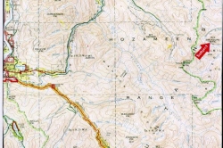
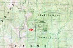
| Location: | These properties are located 30 km (18 miles) southwest of Tulameen and about 26 km (16 miles) south of the Toll Plaza on the Coquihalla Hwy. The properties lie between the Coquihalla Highway and the Tulameen Valley |
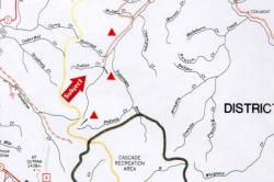
| Access: | Go north of Hope on the Coquihalla Hwy. Take the first exit past the toll both, # 228, Coquihalla Lakes. At the 4-way stop turn right (straight ahead takes you to the rest area). A hundred metres down the road turn left onto the Tulameen Forest Service Road. At 8 km. (5 miles) there is a fork, stay right. Continue right at the fork at both 24 km (15 miles) and 26 km (16 miles). At 37 km (22 miles) the Huldra Silver Mine Road goes up the hill to the right. Go 1.5 km (0.9 mile) on this road . The left fork (down the hill) will take you to the Amberty Creek property and then to Tamarac. (There is a locked gate please call our office before viewing for the combination.) |
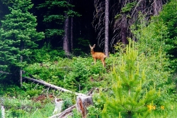
| Recreation: | Abundant deer, some moose and some black bear are found in this area, and there are trout and Dolly Varden in the Tulameen River. As well, there is fishing in the surrounding lakes and streams. A fairly steep mountain road leads through the alpine forest up the mountain and ends in the high alpine meadow. These meadows have small lakes and offer incredible views. Hiking these ridges and meadows is as good as hiking can get. Snowmobiling, snowshoeing and cross country skiing are great on the many trails and alpine meadows. |
| Services: | None. |
| Area Data: | The town of Tulameen sits between the eastern bank of the Tulameen River and the southern end of beautiful Otter Lake. The lake warms up in the summer, providing great boating and nice beaches. There is a general store with a restaurant and basic supplies, including gas, a community hall, a school and a small library in town. Tulameen is home to about 250 residents but this number can swell to 5,000 in the summer months. There is a scenic provincial campground and many summer homes for out-of-town residents who vacation there. Coalmont consists of a general store, post office, Tulameen Rentals (boats, bicycles, BBQ’s, propane), the attractive old Coalmont Hotel (circa 1911) and a number of pioneer homes. Princeton has a population of approximately 2,800 in the town and about 5,000 in the area. The town has 12 hotels/motels, 17 restaurants, six gas stations, one supermarket, seven convenience stores, pharmacy, museum, library, hospital and medical clinic. There are many recreational services such as a 9-hole golf course, horse race track, rodeo ground, swimming pool, bowling alley, curling rink and arena. There is also the popular Snowpatch Ski Resort, China Ridge Cross Country Ski Trails and excellent camping facilities. Princeton is a community quickly becoming a popular tourist destination. The Similkameen and Tulameen Rivers, along with more than 100 lakes, offer outstanding trout fishing. Locals say you can fish “a lake a day as long as you stay”. |
| History: | Coalmont was so named because it was believed that there was a mountain of coal here. However, Coalmont came to the forefront when gold rush activity moved to this village in 1911. After the initial burst of growth, things slowed down considerably, and after a brief revival around 1918, all businesses slowly faded, except for the Coalmont Hotel which is still operating today. The town of Tulameen was earlier known as Campement des Femmes or Otter Flat. Tulameen is from an Indian word meaning “red earth”. Source of the much-prized red ochre, for which Indians traveled from afar, was a steep bank of the Tulameen River four miles north of Princeton. Tulameen had long been a place of congregation for the Salish people, who fished, hunted and gathered wild fruit and vegetables in the fertile Otter Creek valley. Also, the town was one of the stops on the old Brigade Trail from Hope to Kamloops. For 50 years, the brigade trails were the routes of trade and commerce into the interior of the province. Axe blazes more than a century old still mark the Hope-Tulameen Trail and a portion of this historic route was recently designated as a Heritage Trail and plans are underway for its restoration. During the early 1800’s, the fur traders traveling on the Hudson’s Bay Brigade Trail from the west coast to the interior of the province used Vermilion Fork’s area as a stopover. In 1860 the name “Vermilion Forks” was changed to “Prince Town” by Governor Douglas in honour of the Prince of Wales (later Edward VII) who visited eastern Canada that year. As time moved on Prince Town eventually became known as Princeton. The first white settler to the area, John Allison, had originally come to Vermilion Forks seeking information for Governor Douglas. Not long after arriving Allison built a cattle ranch where the town of Princeton is now located. Princeton was incorporated as a village in 1951 and as a town in 1978. |
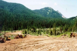
| Vegetation: | These properties were logged in the eighties but scattered stands of alpine spruce and balsam remain. Some of the logged area has been cleared and seeded with grass and wildflowers. |
| Zoning: | RA Boundaries: Surveyed by F.C. Underhill in October, 1926. |
| Sold Date: | 20/10/2004 |
| Re-Sale Year 1: | 02/11/2001 |


