Blair Meadows
| Listing Number: | PG37B, 38 |
|---|---|
| Size: | 328 Acres |
| Map Reference: | 93F |
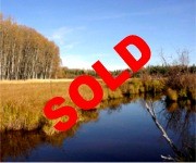
| Price: | SOLD |
| Legal: | SE ¼ Section 24, Township 5, Coast Range 4, Land District 13.NW ¼ Section 19, Township 6, Coast Range 4, Land District 13. |
| Description: | This beautiful 328 acre property has Corkscrew creek running through the centre of the property with a number of smaller creeks running into the main creek. The fields are cleared and could produce some of the best crops of any parcel of land in the entire area because of its natural irrigation. This property has only been used for grazing in the past but it would be profitable to turn these lands into full production for a hay crop. Part of the perimeter of this property is fenced. There are two small log cabins near the north boundary of the property. Cattle from the surrounding ranches graze throughout this area. |
| Location: | This property is located 16km (10 miles) southwest of Vanderhoof in the central interior of British Columbia Canada’s most western province. |
| Access: | Vanderhoof is 97km (60miles) west of Prince George, which is 786km (490 miles) north of Vancouver. From Highway 16 at Vanderhoof turn due south on the paved Kenny Dam Road at the sign that reads Nulki Lake, Tachik Lake and Kenny Dam Road. At 16km (10miles) the pavement ends and this is the east boundary of the Nulki Lake Ranch & Resort. The Nulki Lake Ranch & Resort is on both sides of the main road for 1-½ miles (2.4km). This main road is well maintained throughout the year. Blair Meadows – from Nulki Lake Resort continue on the Kenny Dam Road until the turnoff to the Tachik Lake Resort, which is a four-way junction. Turn left and at approximately 3.2 km (2 miles) turn you will see a sign marked Edwards Road. Continue straight on the road crossing over a cattle guard and continue for approximately 4.8 km (3 miles) you will come to a barbwire fence. This is boundary of the property. |
| Recreation: | This area is popular with local residents and tourists alike, due to the rare combination of natural, unspoiled beauty and the many and varied year round recreational activities available. The fishing and hunting resources attract sportsmen from all over North America. Within a 60 mile radius of Vanderhoof, there are numerous lakes and rivers and many of these lakes offer rainbow trout fishing where you can catch your limit within less than an hour by fly fishing or casting. Moose and deer are very prevalent throughout this area. Activities vary from hiking, camping, boating, canoeing, golfing, horseback riding and water-skiing in the summer to cross country skiing, curling, skating and snowmobiling in the winter. The town of Vanderhoof is known for hosting major year round events, such as Wild West Week, Rich Hobson Frontier Cattle Drive, Slow-Pitch Tournaments, Central Interior Rodeo and Horse Show. Hockey, curling, figure skating, and ringette competitions and tournaments are held all winter. Community badminton, volleyball, basketball and indoor soccer take place throughout the winter season. Murray Ridge Ski Hill is located 60 km away and Vanderhoof residents can enjoy downhill skiing throughout the winter. Burns Lake located 129 km (81miles) west of Vanderhoof is an access point to Tweedsmuir Provincial Park, second largest Provincial Park in the province and one of the largest in North America. It boasts the 4th highest waterfall in Canada, Hunlen Falls. Caribou, moose, grizzly and black bear, mountain goats, mule deer are residents of the park. Boating, fishing, hiking, horseback riding, photography and camping are some of the recreational uses of this park. Access to the park is by light aircraft or via the Ootsa-Whitesail Lakes Reservoir. Boat launching access available at Wistaria on Ootsa Lake and Andrews Bay, also on Ootsa Lake, about 30 km west of Wisteria. Fishing: Ootsa Lake approximately 72 km (45 miles) south of Nulki Resort is part of the Nechako Reservoir and northern boundary of Tweedsmuir Provincial Park. It is a beautiful, large lake, which offers some of the best boating in the province of British Columbia. This huge reservoir links together many large lakes including Tahtsa, Whitesail and Natalkuz. These waters can yield spectacular results for large Rainbow and giant Lake Char. Stuart Lake, is the seventh largest in the province (more than 90 kilometers long and up to 13 kilometers wide). It is a favourite fishing lake, not only for the locals but for fisherman from all over British Columbia, Alberta and the United States who come to travel the Stuart / Trembleur / Takla Lake system. Stuart Lake is accessed from the town of Fort St. James 62 km (39 miles) north of Vanderhoof. The Stuart/Trembleur/Takla chain of lakes is one of the most beautiful and exciting in British Columbia. Stuart Lake has many large, beautiful, sandy beaches along its expansive shoreline. It is both a summer and winter recreational area, with a large number of cabins scattered around the lake, mainly at the southeast end at Sowchea Bay. Sowchea Bay and Colony Point have a large number of recreational residences and a few resorts, and many beaches. A person can travel up the Tachie to Trembleur Lake, up the Middle River to Takla Lake, to the Driftwood River, an unspoiled waterway of some 175 miles (281 kilometers). Lake trout to 9.3 lbs., rainbow trout to 5 lbs. and kokanee averaging 1.1 lbs. are resident in Stuart Lake. Nulki Lake is 8 km (5miles) long (4093 acres) and Tachik Lake is 13 km (8 miles) long (5439 acres). Both are renowned for their excellent fishing and many fishing derbies are held on these lakes. Trout up to 4 lbs. have been caught in Nulki Lake and up to 7 lbs. in Tachik Lake, both in summer and in winter (ice fishing). The Nulki/Tachik Lakes have been for many years recognized as one of the most productive small recreational fisheries in the Vanderhoof area. In the past 15 years a number of projects, generally funded under the Habitat Conservation Fund, have sought to maintain and enhance natural rainbow trout production and recruitment into Nulki Lake. One of the truly unique aspects of the fisheries resource associated with the Nulki/Tachik watershed is the presence of a falls on the lower portion of Corkscrew creek. These falls are readily passable by rainbow trout, but not coarse fish. As a result the portions of Corkscrew Creek upstream of the falls are occupied exclusively by rainbow trout. |
| Area Data: | Vanderhoof (pop.4,470) is a historic ranching and farming community. It is the geographic centre of the province and is located at the junction of Highway #16 and Highway #27. Forestry is the number one industry, followed by ranching and farming. Vanderhoof is in a rich, fertile valley known for its cattle ranches and dairy farms with agriculture as the second largest industry in the region. There is also a growing industry in horticultural production. Vanderhoof is a main service centre with several government offices, schools, hospital, medical clinic, shopping centre, 17 restaurants, 7 hotels/motel, theatre, bowling alley and golf course. The area is served by rail and air (land and float planes). The Vanderhoof Airport has an asphalt runway 5018 feet in length and 100 feet in width and can accommodate most planes. The Nechako River, which joins the Fraser River at Prince George, runs along the north edge of Vanderhoof. There are a number of very nice residences along the river whose owners have both boats and floatplanes. From this river, you can go on waterways for over 200 kilometers, up rivers and lakes. The people of Vanderhoof are low keyed, easygoing people who are mostly hobby farmers with horses and enjoy the outdoors fishing and hunting. |
| History: | Early settlers came in from the south, over the western end of the Telegraph Trail. They traveled up the west coast to Prince Rupert where they boarded river steamers to take them to Hazleton; then they trekked along the Trail to Fort Fraser. Those bound for Fort St. James branched off and followed the pack trail between the two Hudson’s Bay Forts; other continued along the focal point of the Nechako Valley. The telegraph line was erected in the early days with the object of forming an overland connection between America and Europe. The Telegraph Trail followed the line from one end of British Columbia to the other and since it was the only trail into the country, it was also the main artery of travel. Many of the men who had been employed on the telegraph line remained in the north, trading, trapping and prospecting for gold. The Carrier Indians pioneered the land in this area long before the first white man arrived in, what is now known as, Vanderhoof. An ancient Indian village known as Chinlac lies just a few miles east of Vanderhoof on the junction of the Nechako and Stuart Rivers. Simon Fraser’s diary relates that he was the first white man to trade with the people of Chinlac. After the fur traders came the packers, miners, telegraph operators, surveyors and finally, settlers looking for their free land of the frontier. In 1906, the Village of Vanderhoof was only a survey line in the wilderness to mark the location of the planned railway. When the last spike was driven on April 7, 1914, it started a race for the land. The Grand Trunk Pacific Development Company offered cheap land and had one of their employees; Mr. Herbert Vanderhoof lay out the townsite. Vanderhoof is Dutch for “of the farm” which was very appropriate, since it was the first agricultural settlement in the province. The town grew, and in 1926, the Village of Vanderhoof was born. With the arrival of World War II, many young men left, and Vanderhoof came to a standstill. But, with the rise of lumber prices, and the arrival of new people in the late 1940’s, it started to grow again. The next boost to the population and the economy came with the construction of Kenny Dam in the early 1950’s. At the peak of its construction it employed 1500 men, and a number of them stayed in the area after the dam was built. The next expansion period came with a large influx of American immigrants in the 1960’s, and since that time Vanderhoof has enjoyed steady growth. |
| Taxes: | 287.53 |
| Zoning: | RR-1 (Rural resource). Not within the ALR |
| Sold Date: | 04/10/2004 |


