Red Rock
| Listing Number: | Prince George 17 |
|---|---|
| Size: | 160 Acres (64.75 Hectares) |
| Map Reference: | 93g10h |
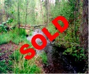
| Price: | SOLD |
| Legal: | Southwest ¼, District Lot 4620, Land District 05 |
| Description: | The east half of the property is quite flat and level except where it slopes down in the northeast corner where the creek intersects the property. The creek runs for a couple hundred yards along the east boundary and leaves the property at the northeast corner. The property slopes from the middle to the west very gently giving an excellent view of the distant mountains and farmlands. There is an old homestead, which is very unique and well hidden. It consists of a hand hown old log home, barn and shed. The barn is in good condition and still standing. The log house could be renovated and fixed up to be livable. There is a small field around the remains of the homestead and an old road runs south from the house to the main road. A road also runs through the centre of the property from the main road near the south boundary through the center to the north boundary. The road has two small clearings on it one being near the north boundary. There are two old small gravel pits off the main road on the property. |
| Location: | The property is located about 20 miles (33km) south east of Prince George on a good all weather gravel road. The property has ½ mile of road frontage. Prince George is located in central British Columbia approximately 500 miles (786 km) north of Vancouver. |
| Access: | From Prince George head south on the Highway 97 towards Quesnel for 26 km. Turn left or (east) on Paterson Road and travel for 6.6 km to the corner of the west boundary of subject project. A couple hundred yards further on Paterson Road you will see a good gravel road turning to the left (north) which runs through the centre of the property. |
| Recreation: | Prince George is a convenient central base for a wide range of outdoor pursuits – from lake and river fishing for trout, char, salmon, steelhead, Dolly Varden, whitefish, sturgeon, and grayling, to canoeing or boating on nearby lakes, to wildlife watching for black and grizzly bear, elk, mountain goats and sheep, caribou, wolves, deer and moose. Visit Tabor Mountain to see these enormous wild vegetarians in their natural habitat. Downhill skiers head for Purden Ski Village and Tabor Mountain and cross-country skiers can find beautiful spots to ski just about anywhere in the area, including Fort George Park, Cottonwood Island Nature Park or an overnight ski on abandoned logging roads to Raven Lake. Golfers can choose from three 18-hole courses in the Prince George area. |
| Services: | None |
| Area Data: | The surrounding area west of the property consists of small farms and hobby ranches. The ranches consist of cow calf operations and a number of horse farms. There are a number of nice residences in the area with large acreage’s where people reside and commute to work in Prince George. To the east the terrain is wooded and all crown land. This is a great area for outdoor winter and summer sports. Redrock Lake is a ¼ miles straight east of the property and has a good size creek running from the lake due west intersecting the northeast corner of the property. An old road runs from the southwest corner of the property to the lake. The property is bordered by crown land on the boundary and this land is covered in large spruce and pine trees. Prince George, B.C.’s northern capital, is the commercial and industrial centre of the region. The logging & softwood pulp industry was responsible for Prince George’s explosive growth in the late 60’s early 70’s and it’s population has demanded a full service city. Prince George has all the facilities one would expect from a city it’s size: a new university built in 1994, a civic centre complex, parks, museums and art galleries. |
| History: | Prince George, originally Fort George, was founded by George III, the reigning sovereign. The Carrier Indian name for this junction of the Nechako and Fraser Rivers was “Thle-et-leh” meaning “the confluence”. The history of the Prince George area focuses on its two rivers. Trappers and explorers used the rivers as transportation routes into the northern reaches of the province. When they discovered that the region was rich in wolf, fox, lynx, mink, wolverine, otter, and muskrat furs, forts and trading posts were quickly established near rivers and lakes so that furs could be sent out and supplies could be brought in. In 1821 the two major fur-trading companies, NorthWest and Hudson’s Bay, amalgamated and Fort George was operated as a Hudson’s Bay Company post until 1915. At this time the first civic elections were held and Prince George was chosen over Fort George for the name of the new city. In 1920 there was a real estate boom in anticipation of the Grand Trunk Pacific Railway’s arrival. By 1951 Prince George was connected with Dawson Creek and the Alaska Highway and in 1958 the Pacific Great Eastern Railway reached town. Hundreds of sawmills started cutting local timber, and Prince George became the self-proclaimed “Spruce Capital of the World”. The Yellowhead Highway connected the city to Edmonton in 1968, three pulp mills opened and all sorts of businesses flooded in. Since then the population has increased at a rapid rate to become the third largest city in British Columbia |
| Vegetation: | The property was logged many years ago and has new stands of pine throughout the entire property. The new pine ranges from approximately 15’ to 20’ tall and now covers most of the property except for the old homestead and a few other areas on the property. There are also some scattered patches of poplar and birch among the pine. There are abundant blueberry bushes throughout the property. The undergrowth is quite open except for the thick stands of regenerated pine. |
| Zoning: | Rural 2 Boundaries: The south boundary is the main Paterson Road. The other three boundaries can be noted from the past logging. The north boundary has been surveyed this boundary is just 30 feet north of the small clearing on the main road. |
| Sold Date: | 04/10/2004 |


